Map Gallery
This compact page contains thumbnails of various maps in my
personal collection that either depict Tluste/Tovste exclusively
or indicate the town's existence in a wider context. Original
titles and dates appear below each image. |
| |
Elsewhere, the Gesher
Galicia website has the best online collection
of historical maps of Tluste, scanned from the original repository:
The
State Archives of Ternopil Oblast, Ukraine.
Click on each image to be taken directly to the respective map
on the Gesher Galicia website. |
| |
| |
 |
|
 |
|
| |
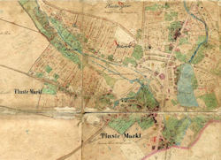
Tluste Cadastral Map - 1858 |
|
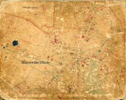
Tluste Cadastral Map - 1899
(partial) |
|
| |
|
|
|
|
| |
 |
|
 |
|
| |
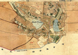
Tluste Cadastral Map - pre-1826 |
|
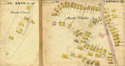
Tluste Town Center - pre-1826
sketch |
|
Click
the thumbnail to view a larger image of the map in my personal
collection
|


))
))
))
))
))
))
))
))
))
))
))
))
))
))
))
))